

















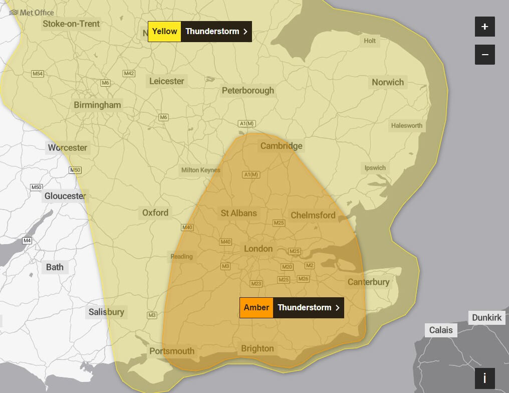
An amber warning for thunderstorms and flooding has been issued across Oxfordshire, with the Met Office warning of intense rainfall, lightning strikes, and surface water flooding from early Saturday morning.
The alert, issued on Friday, 18 July, forecasts torrential downpours and severe weather conditions between 4am and 11am on Saturday. Temperatures are expected to peak at 23°C, with the rain expected to subside by late afternoon.
“Fast-flowing or deep floodwater is likely, causing danger to life,” reads the official Met Office statement.
Flooding of homes, businesses, roads and public transport services is likely, with damage from lightning, hail or high winds possible. Some communities may become cut off if roads flood, and power cuts could occur in areas affected.
Met Office Chief Meteorologist Speaks Out
“Intense rainfall will impact parts of the UK as thunderstorms move in from France,” said Andy Page, Met Office Chief Meteorologist. “The intense rainfall could lead to surface water flooding as well as frequent lightning and hail.”
A yellow warning for the wider region has also been issued from midnight Friday to 9pm Saturday, but the amber warning for Oxfordshire reflects the higher likelihood of significant disruption.
The alert includes a strong advisory for residents and travellers across Oxfordshire:
- Delays and potential cancellations are likely on train and bus services.
- Spray, sudden flooding and poor visibility may result in difficult driving conditions and road closures.
- Power cuts are probable, affecting homes and businesses.
- Flooding of homes and properties is likely, with potential damage caused by floodwater, lightning, hail, or strong winds.
- Fast-flowing or deep floodwater may pose a risk to life.
Why Is This Happening?
Warm, humid air moving up from southern Europe is colliding with a low-pressure system over the UK. The storm cells are capable of delivering up to 70–100mm of rain in a short span. This is particularly dangerous in urban areas like Oxford due to impermeable surfaces and limited drainage.
Practical Safety Advice
Residents are urged to take precautions:
- Avoid driving unless absolutely necessary. Roads may become impassable with limited warning.
- Prepare for flooding: Check your property’s flood risk, move valuables upstairs, and keep a flood kit ready.
- Charge phones and devices in case of power outages.
- Avoid standing under trees or near metal structures during lightning activity.
- Secure loose outdoor items like bins or furniture which could become hazardous in strong winds.
The last amber warning affecting the southeast was for Storm Henk in January 2024, which caused widespread disruption. With Oxford’s dense historic centre and older drainage infrastructure, the city is particularly vulnerable to flash flooding.
Weekend Weather Outlook
- Saturday: Rain and thunderstorms are forecast through the morning, with temperatures rising to around 23°C. Conditions are expected to improve after 5pm.
- Sunday: No weather warnings are in place. Temperatures are set to peak at 24°C, with less intense rainfall and milder conditions.
- Friday (today): The warmest day of the weekend, with highs reaching 27°C across parts of Oxfordshire.
Residents are urged to remain vigilant, avoid unnecessary travel during the warning window, and follow official guidance via the Met Office and Oxfordshire County Council channels.